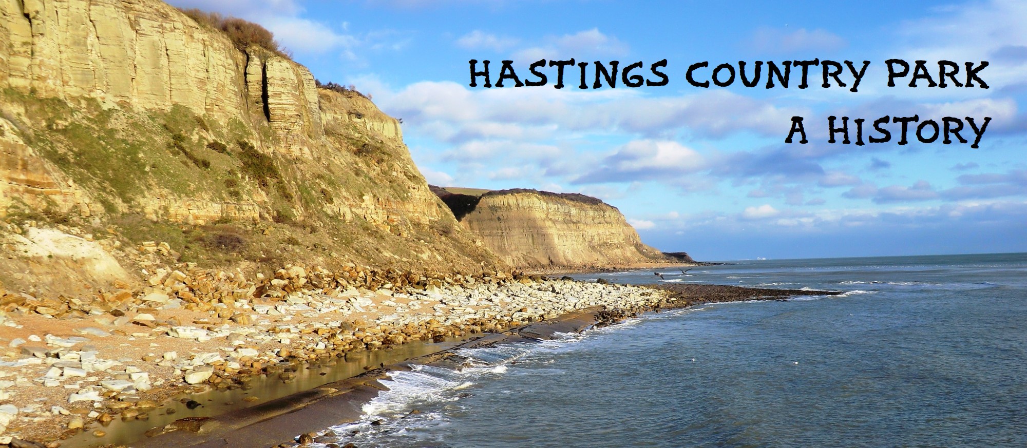
1800-1849
1803 - The March 1802 Treaty of Amiens brought the war with France to a brief halt, but it resumed in May 1803. This highlighted the need for improved defences, prompting the building of the Martello Towers from 1805 (see below) and the setting up of a new beacon warning system along the south coast to help inform and unite the many military forces. The medieval fire beacons had been partly reinstated over the previous decade, but had been found inadequate, so in the early autumn of 1803 a new nationwide chain of signal beacons was set up by the Army. Their main purpose was to alert people inland, leaving the Admiralty’s 1794 signal stations to cover the coast. Fourteen stations were set up in Sussex in 1803, including one on Fairlight Down, with its nearest neighbours (from west to east) Jevington Hill, Brightling, Hawkhurst, Tenterden and Aldington (near Hythe). The beacons were tall simple piles of combustibles, especially gorse. Dragoons were stationed in rough huts by the Fairlight Down beacon, ready to ride with despatches to the Army commander based in Hastings (there were then 2,100 infantry in and around Hastings, including Fairlight Down). A test of the inland network in late 1803 found it was possible to signal warning of an approaching invasion over a distance of 100 miles in 15 minutes. But the many Army contingents in Sussex also needed to be able to communicate with each other, and so at the same time a pioneering telegraph system was set up between Winchelsea and Brighton. A tall mast, with flags, balls and pennants, was erected on Fairlight Down, linked to Winchelsea and Bexhill. The 1803/5 fear of invasion soon passed, however, and as the infantry moved away, the telegraph system either went with them or was dismantled later. The beacons stayed in place for a few years, until the French looked even less of a threat.
1803-05 - The great fears of a French invasion triggered the building of new coastal defensive measures in Sussex and Kent, which became a very profitable business. Edward Milward Snr made bricks and tiles, and in 1803 sold nearly all this output at a high price for new barracks being built in Eastbourne. In early 1805 work began on constructing the line of 46 Martello Towers along the Sussex coast, plus the Redoubt at Eastbourne, requiring about 32 million bricks. Most of the bricks for the towers between Cliff End and Rye came from a large brickyard between Winchelsea and Camber Castle, owned by Sir William Ashburnham and managed by William Shadwell (later renamed Lucas-Shadwell). Overseeing the early construction of all the Sussex towers was a Mr Dalloway, who lived at Fairlight Place until late 1805.
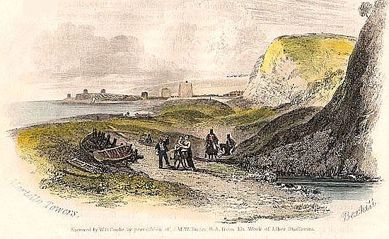 JMW Turner's picture in 1817 showing the Martello Towers at Bulverhythe and, in the far distance, Galley Hill. Turner was standing where the Royal Victoria Hotel is today on St Leonards seafront.
1811 - Death of Edward Milward Snr, born 1723. He and his father-in-law John Collier (1685-1760) were seen as having been the most powerful individuals in the town for almost a century. He bought Old Hastings House from a relative in 1796. His property passed to his only son Edward Milward Jnr (1765-1833). Local journalist and author Thomas Brett recalled that Edward Snr had been mayor every other year for half a century, but was an invalid for some few years before his death and left the mayoral business in the hands of his son and Mr John Goldsworthy Shorter. 'During his long life he [Edward Snr] had become a very rich man, and was less a philanthropist or public benefactor than was his son.' Edward Jnr in 1817 married Sarah, daughter of the local Rev William Whitear. But the marriage was childless, and when Edward Jnr died in 1833, the estate passed to Sarah (1787-1873). She was very generous, aiding many charities.
1811-12 - Fairlight Place, Fairlight Down and other land was sold by Sir Godfrey Webster to Edward Milward Jnr. The Down had been common land of some kind, but Milward enclosed much of it with hedges and banks, and later sold some of the lower western slopes, where houses were built to form Ore village. In October 1811 there was an auction of Fairlight Place Farm’s stock and tackle, including 350 ewes, 120 lambs, five pairs of oxen, plus cows, heifers, four cart horses and much equipment.
1811 July - The 'small genteel freehold villa called Fairlight Lodge, or the Octagonal Cottage, [on the corner of Martineau Lane and Fairlight Road] and upward of 24 acres of meadow and arable land' were sold by auction in London to Dr Robert Batty; the quote is from the auction bill. The Lodge (the date of the building is unknown) was also called the Lantern House, perhaps because its octagonal section looked like a lantern, and also because it may have had a lantern giving signals to smugglers (it was on a route inland for smugglers). Martineau Lane was then only going north from Fairlight Road, in front of the Lodge, as far as the bottom of the hill. Dr Batty moved the first 150 yards of the lane to the west, to distance it from the Lodge, to where it is today. In 1819 Batty’s daughter Elizabeth (d 1875) married Philip Martineau, a Master in Chancery. The family was descended from Gaston Martineau, a French Huguenot refugee who fled to England in 1685. She inherited her father’s property when he died in November 1849 in the Lodge, and gave her husband’s name to the lane (it was first called ‘Martineau’s Lane’). This was just as the construction of Fairlight Hall was starting, and with it the new northern half of Martineau Lane, from the bottom of the hill to Winchelsea Road. Elizabeth’s son Robert Martineau was a friend of William Holman Hunt and John Millais who stayed with him in the Lodge in 1852 (and possibly other times).
1819 Summer - A Coast Blockade Service (CBS) watch house was built on a large rocky platform near the bottom of the cliff at about 100 yards to the east of Ecclesbourne Stream. The CBS, consisting of armed Navy men nicknamed the Warriors, was the forerunner of the Coastguard. The CBS was set up in 1817 to replace the 1809-formed Preventive Water Guard, which had been aimed at stopping smuggling as well as giving anti-French defence. All this had started in the Hastings area with the building of ‘The Battery’ on the seafront at the west end of West Street in 1759 because of fears of a foreign invasion. Also c1759 the military had a nearby piece of ground at the west end of George Street where they built Government House, with accommodation, stores etc, which was to be the headquarters of military, naval and Coastguard operations in the Hastings area. In 1899 the Government House (then called Marine Parade Coastguard Station) was demolished and rebuilt as a block of flats, work rooms etc, called Sturdee Place, which was the Coastguard HQ until 1927.
 The Haddocks in 1917, with a Coastguard on watch.
Around 1819 a CBS watch house was also built at the Haddocks, Fairlight Cove, and another at Fairlight Head, there either re-using, or roughly on the site of, the 1795 signal station. An Admiralty semaphore station was also erected at Fairlight, which the CBS used. All three watch houses - Ecclesbourne, Fairlight and Haddocks - were later taken over by the Coastguard, which was formed in 1822 under the Board of Customs, although the CBS continued until 1831. The Ecclesbourne Station was extended in 1832 and a groyne was added on the east side in 1836 because the sea was encroaching following the construction of groynes at Hastings. It was washed away in 1859.
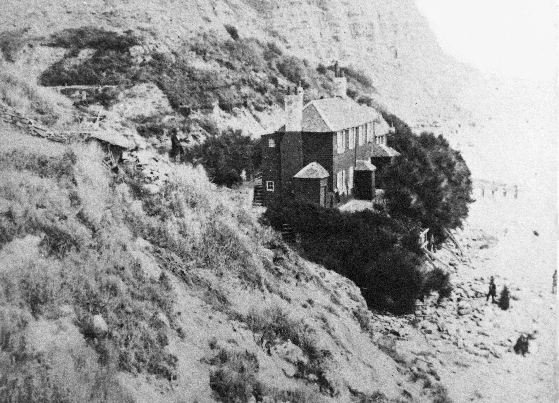 The CBS Watch House at Ecclesbourne. Built in 1819, it was destroyed by severe weather in 1859.
1825 July - Sir John Herschel took long-range survey readings close to where North’s Seat is today in order to help determine precise calculations for degrees of longitude. The operation measured the difference in longitude between the Paris Observatory and the Greenwich Observatory. Two observing stations were set up in England, with Fairlight making the cross-Channel link with La Canche in France.
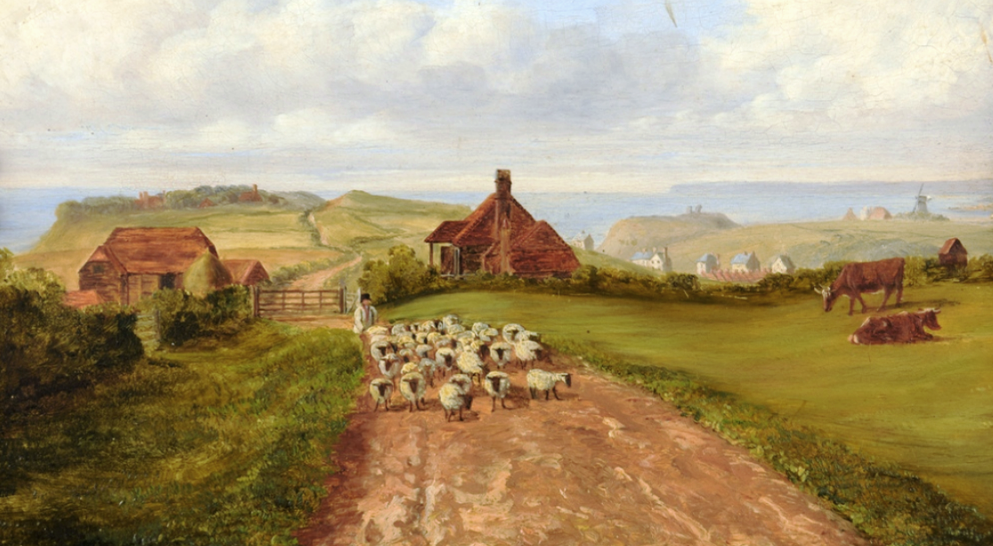
1828-37 - Warren Farm and its estate was put up for sale several times in almost a decade. In August 1828 it was advertised as a substantial farm house, three cottages, barns, an oast house, stables and 577 acres of 'arable, meadow, pasture, wood and rough land ... in a high state of cultivation'. It had almost a mile frontage of the sea, and was 'within a ring fence'. It went unsold, and in July 1830 it was put up for auction, with the added inducement that it could become the site of a new town of Hastings. This was just two years after work had started on building the new upper-class town of St Leonards. The auction was unsuccessful, and in August 1835 the same buildings and 577 acres were put up for auction again. Some of the estate may have been sold, as in July 1837 the estate was advertised for sale yet again, with the same buildings, but with the acreage reduced to 487. The failure of the previous sales can be seen in the 1837 advertisement, as it says the estate could be viewed 'on application to the Proprietor on the premises, who has resided there upwards of 30 years'. It may have been in 1837, or soon after, that the estate became part of the Lucas-Shadwell Estate centred on Fairlight Hall in Martineau Lane.
1830 Nov 3-4 - Serious disturbances broke out in the countryside around Hastings and in neighbouring parts of Kent, being the start of the Captain Swing uprising by impoverished rural workers trying to stop their conditions becoming worse. On these two days the insurrection was especially bad around Battle, with barns and ricks being burnt, and a large crowd surrounding the George Hotel. A few days later farm labourers at Fairlight physically removed the Fairlight Workhouse overseer from the parish, never to return, and local farmers agreed to give them a wage rise. Other action in neighbouring parishes also won rises. The direct-action movement petered out in the summer of 1831, but the upper class felt so threatened by it that the Poor Law, giving aid to the poor, was made much harsher and the workhouses were turned into last-hope places of fear, rather than help.
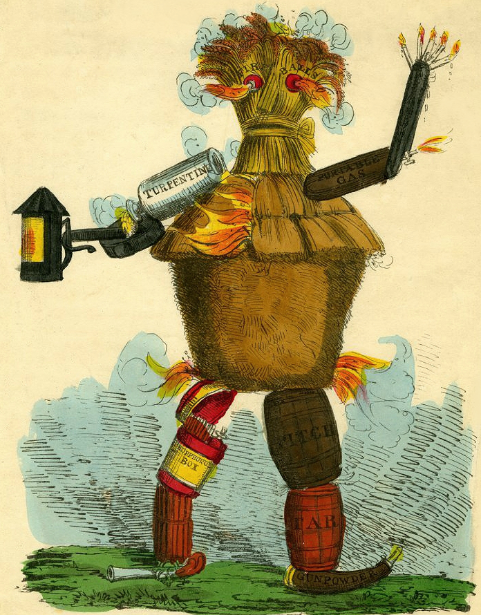 Captain Swing getting ready to start a fire.
1831 Jan 5 - Two smugglers - William Cruttenden of Hastings and George Harrod of Guestling - were shot dead on the beach at Fairlight Glen by military officers under attack from a large group of smugglers. A jury later decided it was justifiable homicide. Smugglers are believed to have played a leading role in the Captain Swing uprising at that time.
1832 - In about this year prominent Tory politician Joseph Planta (1787-1847) became tenant of Fairlight Place. He was elected Hastings MP in 1827 and was Joint Secretary to the Treasury. He held a huge outdoor party to mark Queen Victoria’s coronation. The Duke of Wellington visited in 1837.
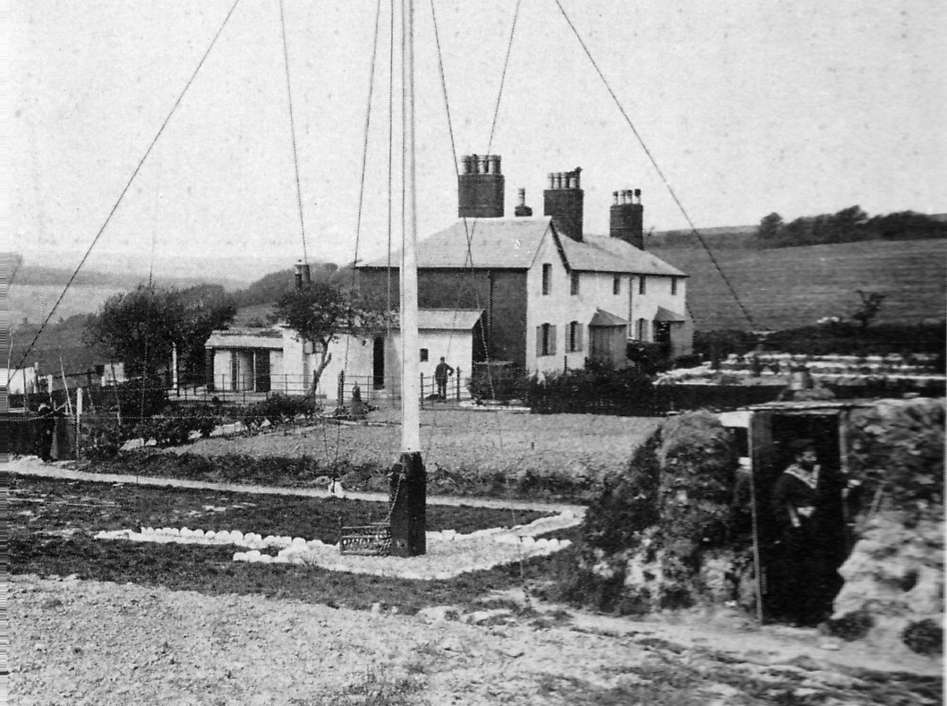
1832 July - The Coast Blockade Service had largely won its fight against smuggling, so it was abolished in 1831, with the Coastguard taking over its roles and investing in them. This included the leasing in July 1832 of more ground for the Ecclesbourne Coastguard Station for an extension. Its new area was 50 ft by 323 ft, with much of the extra land to be a garden. A parade with bastion protected the building from the sea. At the same time the Haddocks station at Fairlight Cove was rebuilt. This included a terrace of five small houses, the eastern one of which still stands on the edge of the cliff.
1833 - Edward Milward Jnr died, and as he had no children, his estate passed into the hands of his widow, Sarah (1787-1873). She was the youngest daughter of Rev William Whitear, Prebendary of Chichester, and Rector of All Saints, St Clements and Ore. Born in St Clements Rectory on 17 January 1787, she married Edward Jnr in March 1817. On his death she became the ‘owner’ (estate manager) of the West and East Hills, Fishponds Farm and much other property, totalling more than 2,500 acres. In December 1846 she married, as second wife, Royal Navy officer William 8th Earl Waldegrave, thereby becoming Sarah Countess Waldegrave. The earl died October 1859. Sarah was a well-known local benefactor, a strong Protestant, of stern character but great generosity. She established one of the town’s earliest Sunday Schools more than 60 years before her death, and founded the infant school in Cavendish Place. She laid the foundation stones of many churches: Halton 1838; Fairlight 1845; St Mary Magdalen 1851; Holy Trinity in Robertson Street 1857; Christ Church, Ore 1858; St Matthew, Silverhill 1860; Hollington new church 1865; and the new parish church Ore 1869. She gave sites for the 1835 boys and girls school in All Saints Street, and for Halton schools. She donated £500 each to All Saints and St Clements church restorations, also the St Andrews church extension; plus £500 as endowment for the Halton organist. She erected the public baths and wash-houses in Bourne Street for almost £2,000, which was of great benefit to the wives of fishermen who could supplement the low family income by running their own laundry business. For the Rifle Corps, she gave £250 to clothe the men, and provided the rifle ranges in Ecclesbourne Glen, and helped to obtain the drill ground in the Central Recreation Ground, for which she gave £1,000 to help the purchase. Luckily for Hastings, most of her relatives who were to succeed her as managers of the Milward Estate shared her social concerns and generosity, thus sparing the town from the speculative development that was seen on most other estates in and around Hastings and St Leonards.
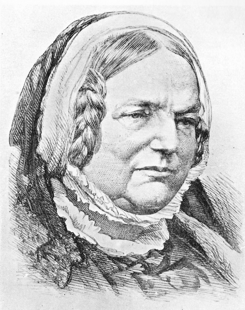 Countess Waldegrave, in later life.
1833 Oct - Construction was completed of the town’s first water reservoir, in Clive Vale. It held 800,000 gallons. The 3.3 acres had been bought from Edward Milward Jnr early in 1831 for £100. By the early 1840’s the reservoir was found to be too small, so a second one, holding two million gallons, was built immediately downstream of it. This was completed by April 1844. Both still exist, off Harold Road, opposite Githa Road, and are used for angling.
1839 - Detailed tithe maps were made of all parishes, giving the first comprehensive overview of what is now the Reserve.
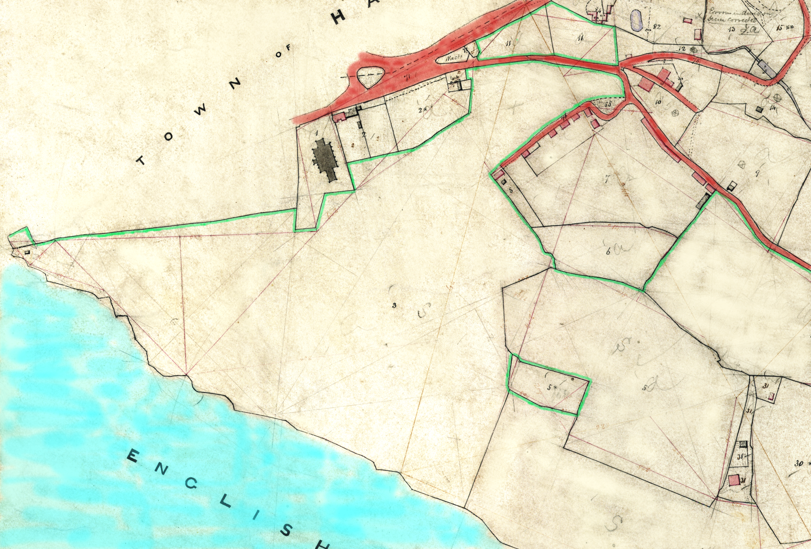
The landowners: The maps show Sarah Milward as being the owner of all of what is today the Reserve (including Fairlight Down) as far east as Warren Glen, with most of it run from the 720-acre Fishponds Farm. The Milward eastern boundary at that time was Warren Glen’s stream, from the sea inland to a point on it 325 yards (300 metres) south of Warren Cottage; then a line running north-east through roughly the middle of the big quarry; to the fence on the west side of today’s car park; then to Fairlight Road. The land to the east of that line - south of Fairlight Road and taking in Coastguard Lane, the car park, the Firehills and most of Fairlight Cove - was part of Warren Farm and Waites Farm, themselves a section of the massive estate then owned by William Lucas-Shadwell, the local solicitor and speculator from a wealthy old Sussex family. (The Lucas-Shadwell Estate was auctioned in 1917 and the Milward Estate probably then bought the eastern side of Warren Glen to Coastguard Lane, plus about 200 yards of the Firehills east of the Coastguard Station.) Sarah Milward looked after the Milward Estate from 1833 and made it more publicly accessible. It was after her death in 1873 that the estate began to be sold in parts. The largest farm in the Reserve area in 1839 was the Milward’s Fishponds Farm. Neither Fairlight Place Farm nor Shear Barn Farm were separate farms, as they were then just out-stations of Fishponds. The Milward Estate then owned 1,516 acres in the parishes of Fairlight, All Saints (eastern Hastings), Ore and Guestling, plus well over a thousand acres elsewhere.
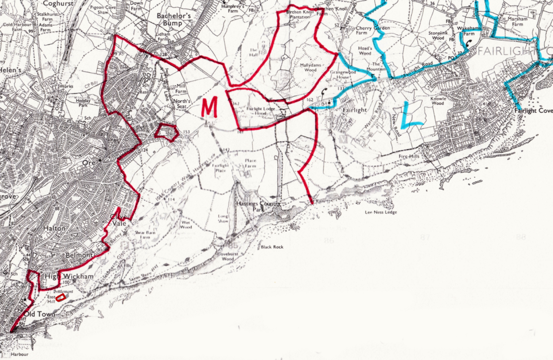 This is the land owned by the Milwards (in red) and by Lucas Shadwell (in blue) in 1839, tranferred onto a recent map (by Steve Peak).
The land: The tithe maps and their schedules give a similar picture to that of the Ordnance Survey drawings of 1797-1806. The only significant woodlands were: Brakey Bank (then unnamed) in Warren Glen; Gill Wood in Fairlight Glen (the north-east quarter of the glen) and Long Shaw; and in Ecclesbourne Glen, the gill around the stream near the bottom of the glen and at the top from where the reservoir is today, north-east past Fishponds Farm. There were also many small pieces of woodland north and west of Fishponds Farm, including Pinders Shaw (then called Pindle Shaw), and adjoining the streams in Warren and Fairlight Glens. All the other land was arable and pasture farmland, including what may have been ‘common’ land, much of which was called ‘rough pasture’. Tilekiln Lane was more significant than today, with a track connecting to Barley Lane, as seen on other maps. There was also the Barley Lane extension north-eastwards to Fairlight Road, but the old road running south-east from there past Warren Farm towards Cliff End was not on the tithe map.
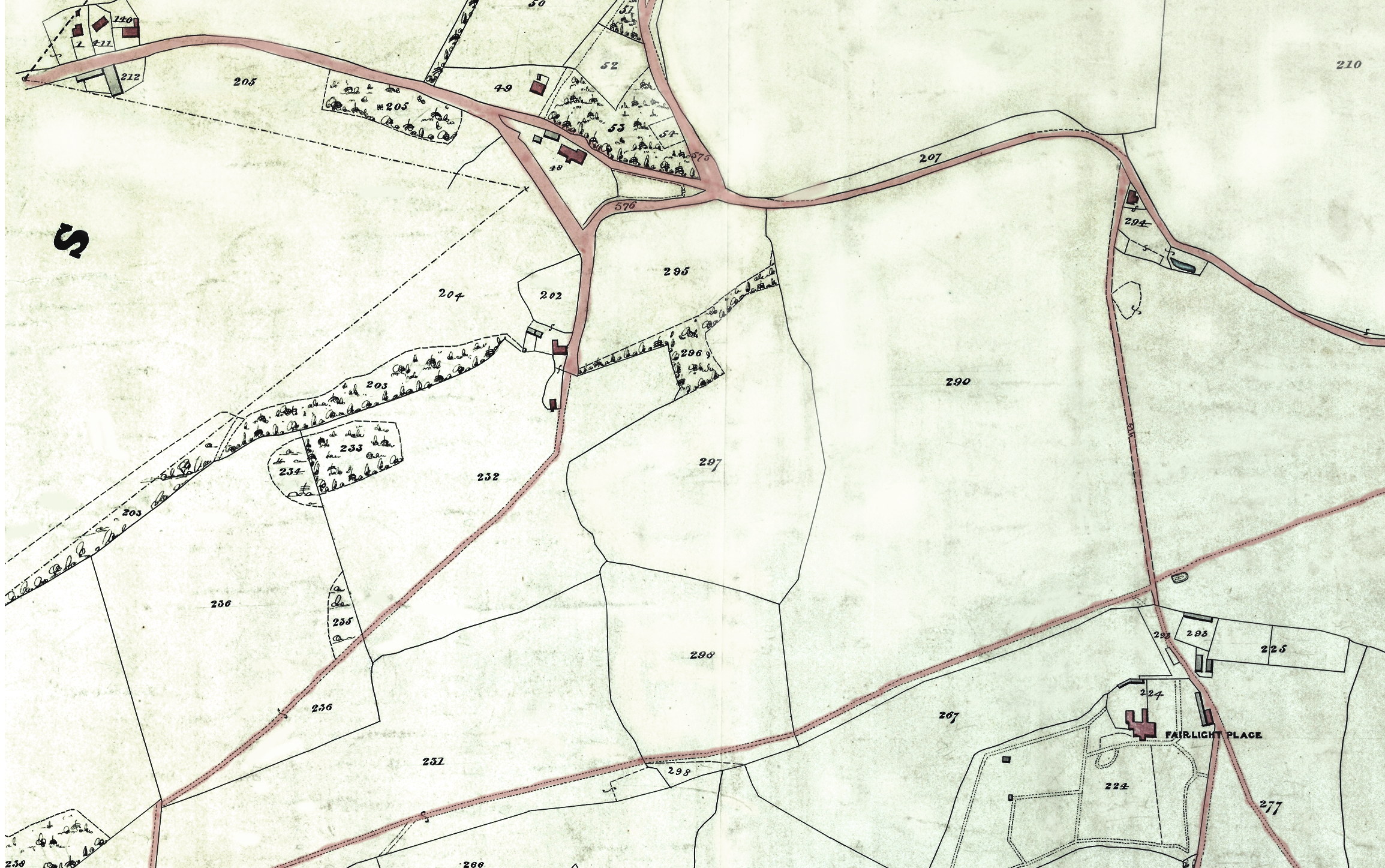 The 1839 map. The bottom lane is Barley Lane, continuing eastward across the field to Fairlight Road. Tilekiln Lane (centre left) runs south across the fields to Barley Lane and in the north joins Fairlight Road. In the top left corner is Tile Kiln Farm, now where houses are in Fairlight Road.
The buildings: No new settlements were marked. A barn (unnamed) was shown where the New Barn was on later maps, and not where it was on the earlier Ordnance Survey drawings. There were two windmills on the west side of Mill Lane on Fairlight Down: one stood at the lane’s 90-degree turn, close to today’s Hillcrest School, the other on the later site of North’s Seat. The only quarry was in the field on the west side of Fairlight Coastguard Station; there was no quarry marked near the church or near Warren Cottage, where they were to be set up. Today’s picnic site on Fairlight Road and the field north of it were one field, called the Cricketing Field. The field at the top of what today is the Ecclesbourne Meadow was then known as the Church Field. The Firehills were called The Hills.
 The East Hill on the 1839 tithe map. Most of the top of the hill is non-agricultural open space. It is edged in green (by the author here) to show it is owned by the Milward family, as is Rocklands and the fields to the east. The green box on the hill is owned by the church. All Saints Church is the large black building. On the right is Barley Lane.
1840 Jan 29 – The Cinque Ports Chronicle of this date reported that 'an ancient earthen vase, of rude workmanship, containing about 30 brass coins' had been recently dug up inside 'the Roman encampment on the East Hill' (now the picnic site). The coins were believed to mainly date from the reigns of Hadrian 117-138 AD and Constantine 305-337 AD. The 'encampment' was then being let by Mrs Milward on the ‘cottage garden principle’, like allotments today. The vase was broken by the digger’s spade. Several of the coins were acquired by Mr Cooper who ran the Marine Library.
 Looking down Barley Lane in about 1840. Shear Barn Farm is on the left.
1846 Aug 7 - The consecration of the new Fairlight Church (St Andrews) took place. Its foundation stone was laid in May 1845 by Sarah Milward, who had donated £1,000 towards the cost of the building. William Lucas-Shadwell donated £500, plus a large quantity of stone for the church from his quarry. The smaller previous church, built in 1180, had been in danger of collapse and had been buttressed. Both churches have been landmarks visible for many miles, and especially useful to seafarers. The 1846 church stands 536 feet above sea level and the tower rises a further 82 feet, to 618 feet. Members of the public can see the breathtaking view from the top of the tower on many days in the summer. Buried in the churchyard are Countess Waldegrave and her husband, members of the Lucas Shadwell family, the famous musician Richard D’Oyly Carte and the parents and a sister of Cecil Rhodes, founder of Rhodesia (now Zimbabwe). Members of the Rhodes family lived at Fairlight Place for two decades, from the late 1870s.
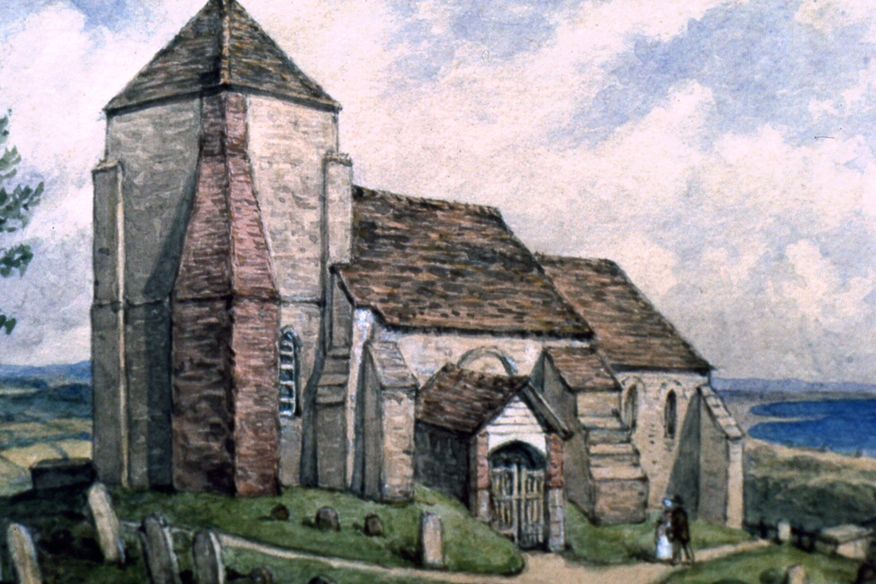 The 12th Century Fairlight Church.
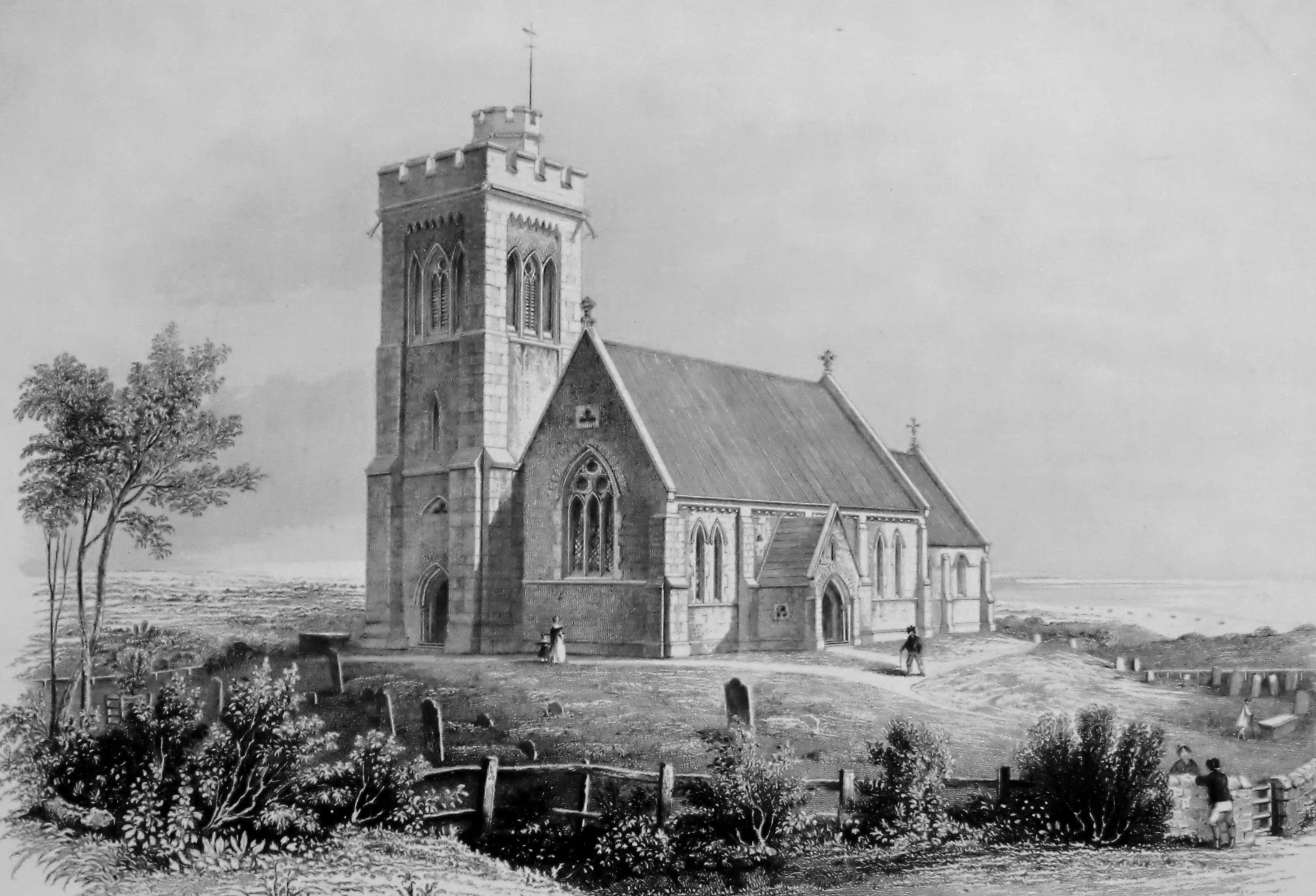 Its 1846 successor.
1846 Dec - Sarah Milward married the eighth Earl Waldegrave, becoming the Countess Waldegrave. The earl died in 1859. Sarah lived mainly at Old Hastings House at the top of the High Street, where she died in 1873.
1847 - Fairlight School was built by the authorities of Fairlight Church. It closed in 1957. The school and schoolmaster’s house, standing opposite the entrance to the church, are both listed, and today are private dwellings. Before the First World War the Sayer-Milwards donated part of the adjoining field on which the children could play.
1849 Spring - Following the overthrow of the French monarchy by a popular uprising in February 1848, the former king, Louis Philippe, and his wife Queen Amelie, escaped from France and lived in England. For about five months in 1849 they stayed in Hastings and St Leonards, and it is believed that at least some of that time was spent in Fairlight Place, for on 2 July 1849 there was a meeting there of many French dignitaries, plus the Queen of Belgium (Louis’s daughter Louise Marie).
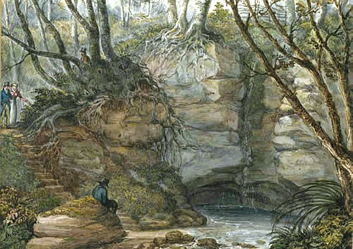 Fairlight Glen was famous for its 'Dripping Well' waterfall. The first, seen here in 1824, drained off the New Barn Pond on the top of the west side of the Glen.
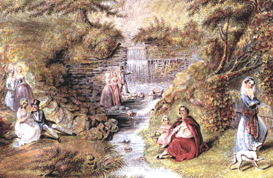 But the first Dripping Well was difficult for these well-dressed ladies to access, so the waterfall near the top of the Glen's stream, here in 1850, took over as the attraction.