1700-1799
1723 - Birth of Edward Milward Snr; who died 1811. He and his father (also Edward, 1682-1749) acquired a large amount of land in the Hastings area. He was mayor 26 times and the pillar of the local establishment. He was a strong character who let nothing oppose him. In 1754 he married Mary Collier (1725-1783), a daughter of John Collier.
1724 - The first fairly-detailed small-scale map of Sussex, by Richard Budgen, shows a windmill on Fairlight Down. This would have stood in Mill Lane, not at Lover’s Seat, opposite Mill Farm. It was run by the Carswell family.
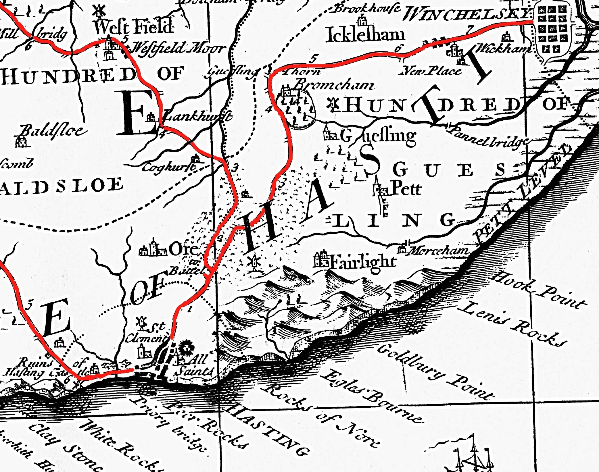 Budgen's 1724 map (the author has coloured the roads).
1745 Dec 25 - During the 1745-46 Jacobite Rebellion, when Charles Stuart tried to regain the British throne for his father James, the Navy set up a communications network between Beachy Head and the North Foreland by asking the wardens of prominent churches along the coast to prepare to hoist a flag by day or light a fire in an iron pot at night on their tower or steeple. Rye, Fairlight and Pevensey churches were the links nearest to Hastings.
1746 - Hastings Corporation published a map by local surveyor and schoolmaster Samuel Cant of the borough boundaries. The eastern boundary ran up the west side of Ecclesbourne Glen to Tilekiln Lane.
 Ecclesbourne Glen, in part of the 1746 borough boundary map.
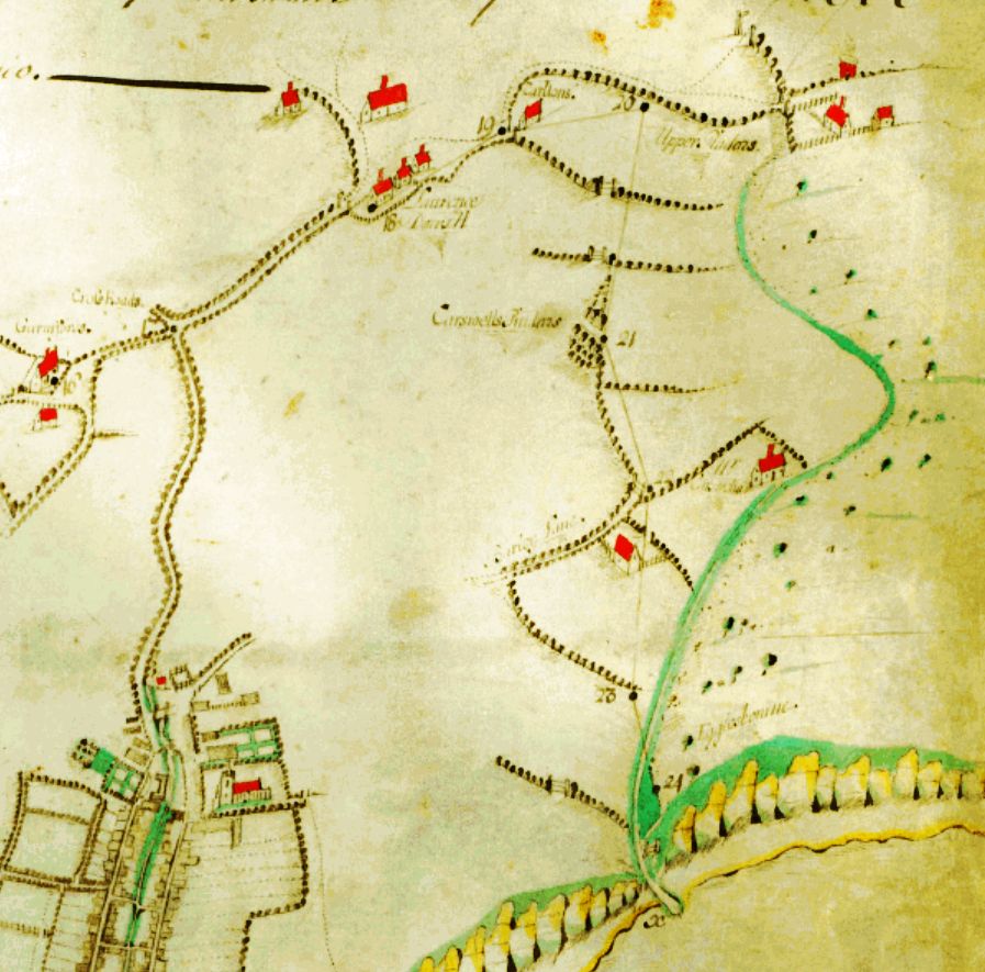
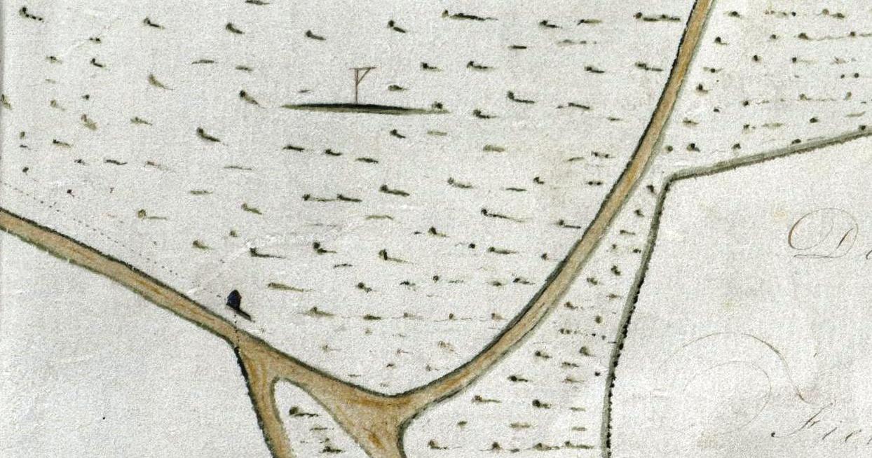
1750 - The earliest known large-scale map of Hastings was produced in this year. It was made by Samuel Cant for John Collier, and showed land that he owned on the East and West Hills, and in the Old Town, Clive Vale and Priory Valley. The East Hill was laid out as fields, with St George’s Churchyard, called ‘Beacon Hill’, containing a large signalling flag pole with a gibbet in its south-east corner. Ecclesbourne Glen was called ‘Egglesbourne’.
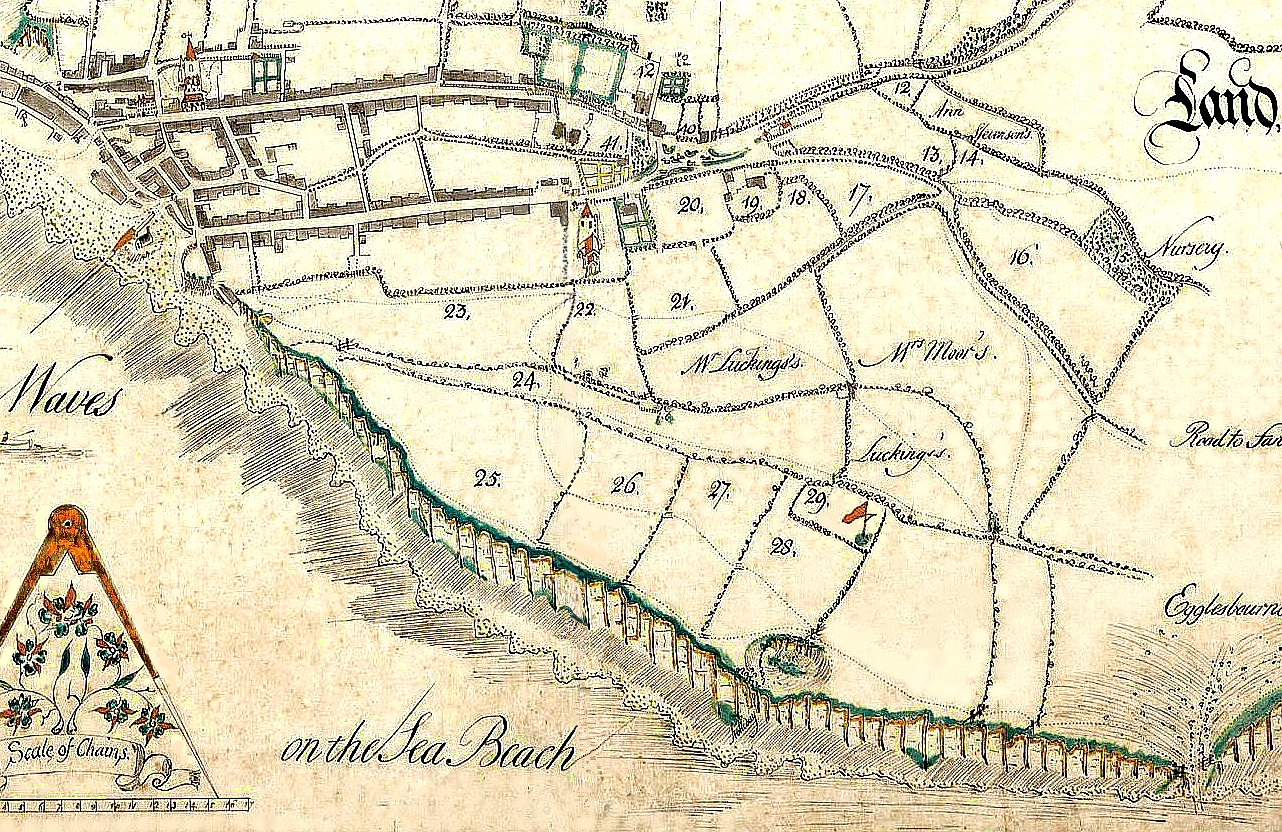 The East Hill, on the 1750 map of John Collier's estate. Note the gibbet on the flagpole. Collier owned the numbered properties. Edward Milward revised the map in 1769 after inheriting the Collier estate to show he also then owned Mr Lucking's two marked fields, and the two fields east of the flagpole.
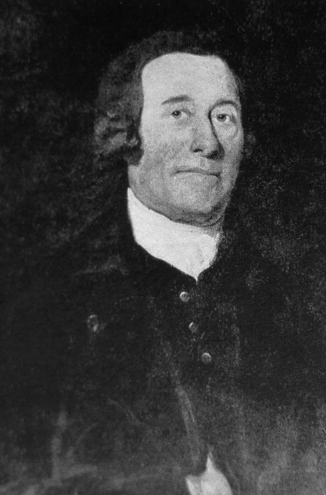
1760 Dec 9 - Death of John Collier, aged 75, the most powerful establishment figure in Hastings from c1710 onwards. Born 1 November 1685, he came from an Eastbourne family of moderate means. He was appointed Hastings town clerk in 1706 and became a solicitor, judge advocate, banker, property manager and government agent, most notably as Surveyor General for the Customs for Kent (ie, head of Kent’s anti-smuggling forces) from 1733. He undertook estate agency for many notable Sussex families, especially the Pelhams with whom he had long-term close ties via the powerful Duke of Newcastle (Thomas Pelham), who was prime minister 1754-56. At that time there were no banks, and Collier made a great deal of money from acting as a personal banker: people brought him their cash to look after, and he could invest this ready money in property which would generate enough return to pay back the ‘borrowed’ money. In this way he obtained many acres of land, including much of what is today the Reserve. When he died he had £31,000-worth of land in Sussex, Kent and Surrey. He had 24 children, but only five daughters survived him, one of whom, Mary, married Edward Milward Snr in 1754. Two years later Collier was able to assign his post with the Customs, usually considered to be a good source of income (legal or illegal), to Milward Snr, then his son-in-law, along with the role of local agent for the Duke of Newcastle.
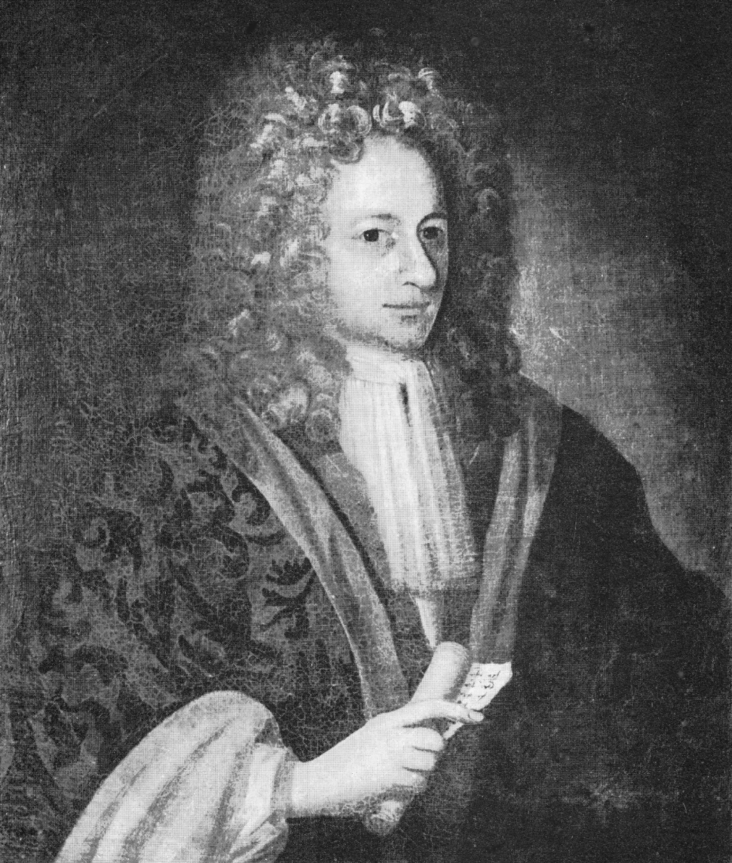 John Collier (above) and Edward Milward Snr.
Edward Milward Snr acquired most, if not all, Collier’s property on his death in 1760, and by the end of the 18th century Milward owned most of the undeveloped land between the West Hill and Warren Glen, plus much other property across eastern Sussex. Collier’s widow Mary wrote in 1764: 'The way he [Milward Snr] goes on here is quite amazing to all the world; neither house nor land within ten miles of this place that he will not purchase if it’s possible, by offering more than people can withstand.' Another daughter of John Collier, Cordelia, married Major-General James Murray, Governor of Quebec Province 1763-6 and the builder of Beauport House at the west end of the Ridge.
1765 - A Milward Estate document refers to 30 occupied acres of land at the Govers (now Covehurst, almost on the beach at the bottom of Fairlight Glen), which had a house, a barn, other buildings and gardens. The occupant/tenant was Robert Tunbridge. In the spring of 1780 there was a serious outbreak of smallpox, and for a long time the house was used as a ‘Pest House’, from which non-infected people were banned. On 28 March 1781 the Town Crier declared 'This is to give notice that if any person or persons are found out in frequentation of the Govus House near this town now made use of as a Pest House for the Small Pox, who are not properly authorised by the Parish Officers to frequent the same, will be prosecuted as the law directs.' The house is in several contemporary drawings.
1769 - The 1750 map of the Collier Estate was amended when the property passed into the hands of Edward Milward Snr. A significant change is the south-east corner of Beacon Hill, where the mast has been replaced by a gibbet. A gibbet also appears on the 1795 map of Sir Godfrey Webster’s estate of Fairlight Down, standing near where North’s Seat is today.
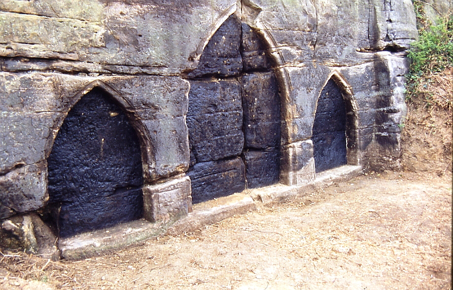
Late 18th Century - John Coussens carved the three large ‘Black Arches’ in a sandstone outcrop on the East Hill, above Tackleway, as a hoax, fooling visitors into thinking there was a church in the hillside. They are still visible today, although covered in graffiti.
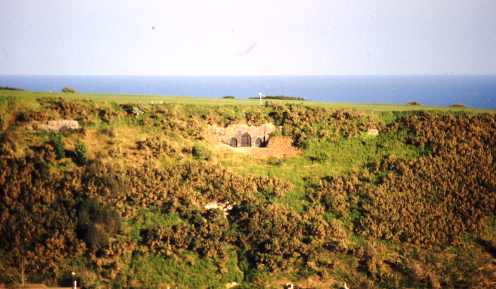 The Black Arches on the East Hill, in May 1990.
1778-79 - Regiments of troops were encamped on the Ridge, on the north-west side of the junction with Winchelsea Road.
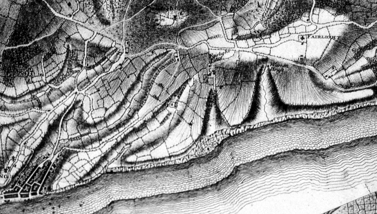
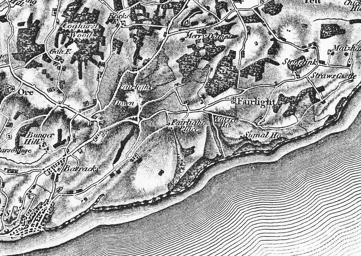
1778-83 - Surveyors Yeakell and Gardner produced the first detailed map of all Sussex. The two inches-to-the-mile map shows most of the Reserve as fields, with little woodland and few buildings. Barley Lane continues eastward to the top of Martineau Lane, and a little further along Fairlight Road a now-lost road goes south-east across a field towards Warren Farm.
 1783 Yeakell Gardner map.
1786 Jan - The Lovers' Seat lovers - Elizabeth Boys (daughter of the High Sheriff of Sussex) and Capt Charles Lamb of Rye - were married. Capt Lamb was the commander of an anti-smuggling revenue cutter, the Stag, who courted Ms Boys, of Hawkhurst, despite the opposition of her father. She was staying at Fairlight Place, so the pair could only meet in secret at Lovers' Seat when the captain’s vessel was off that part of the coast. After marrying, the couple lived happily for 28 years until the captain died at sea. There have been many romanticised versions of this story, not least because Lovers' Seat was a most unusual and attractive spot for lovers of all kinds to meet. What became known as the ‘seat’ was a slab of sandstone rock at the highest cliff-top point between Fairlight and Warren Glens. It projected out over a secluded bench, about 20 feet below, where lovers could come together. The slab fell at some point in the 19th century and was replaced by a hand-cut slab, seen in many photographs. A major cliff-fall in 1961 removed this slab, plus the bench and the surrounding cliff-top, so the site of the original seat no longer exists. The slab was pulled back up the cliff, however, and now lies in the grass next to the cliff-top path.
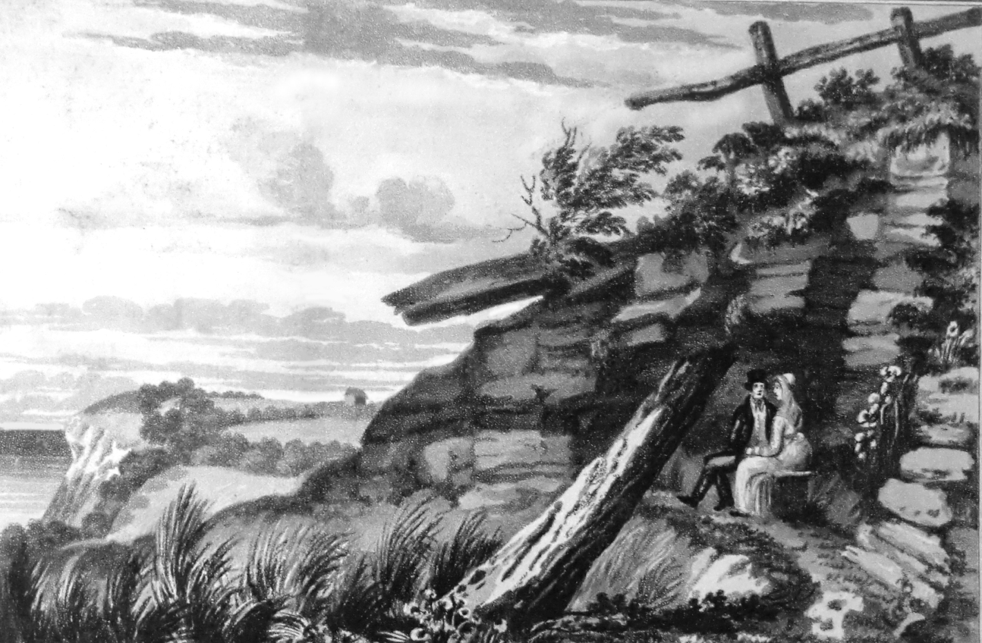 Lovers in the late18th century. In the far distance is the barn where the New Barn Pond is today.
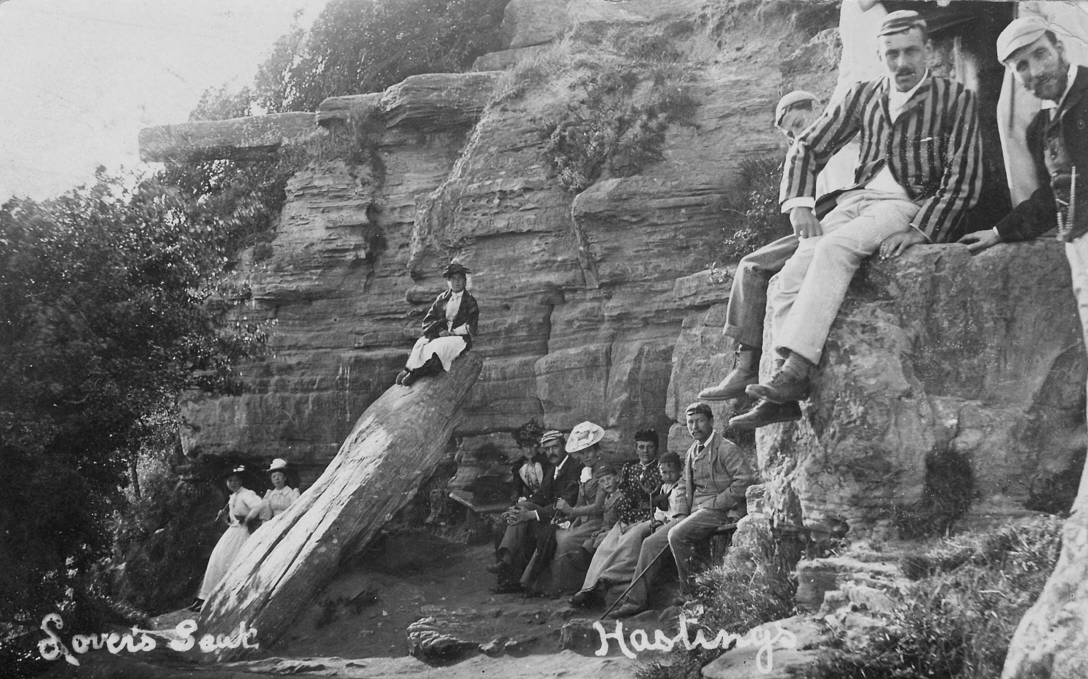 Edwardian lovers.
1787 Sept-Oct - General William Roy set up a 32-feet high scaffold tower supporting a theodolite on Fairlight Down. It was recorded as being sited 347 feet south of the windmill that then stood opposite Mill Farm. That position is where the concrete triangulation pillar ('trigpoint') is today, a few yards north of North’s Seat. He was making long-range observations as part of the triangulation survey linking London and Paris that resulted in 1791 of the setting up of the Ordnance Survey, the world’s first official surveying body. Fairlight and Dover were the key two English cross-Channel observation points, the only locations from where stations both in France and a long way inland in England could be seen. The 1787 survey enabled the production of the first one-inch-to-the-mile maps, which began in the 1790s. Trigpoints were built following the start in 1936 of a major project to map out the shape of Great Britain. Most trigpoints are of a standard design, about four feet tall. On top can be sited a theodolite (an accurate protractor built into a telescope) which measures angles between pairs of nearby trigpoints, a process called 'triangulation'. There is also a trigpoint on the East Hill, in dense bushes on a mound on the west side of Rocklands Lane where it enters the hill. The trigpoints system is now not in use, but when it was, the east Hill and Fairlight Down pillars could see each other.
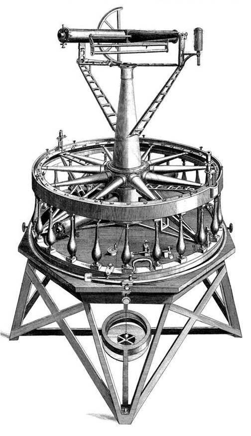 The 1787 theodolite.
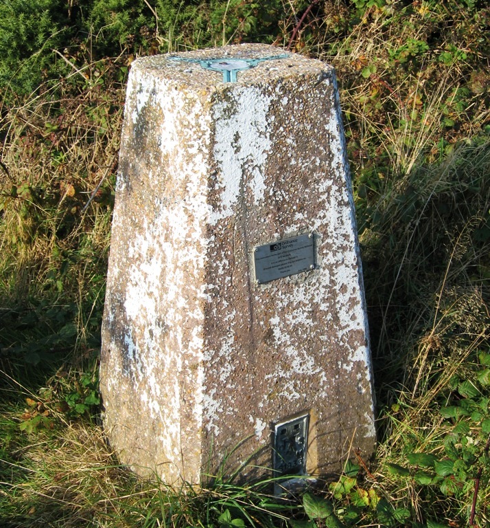 The trig point at Fairlight Down.
1792 - The name ‘East Hill’ first appeared in deeds. Prior to that, from at least 1540, it was called St George’s Lands (later St George’s Hill), with the enclosure on top of the hill known as St George’s Churchyard, although there is no record of a church on the East Hill at any time. The name may have come from the hill after 1400 being part of the Manor Brede, and its tenants had to pay their dues to Brede, so they may have come to associate the hill with St George’s Church in Brede.
1793-1815 - During the Napoleonic Wars, Hastings was in the front line because it was so close to France. In fear of a French invasion, troops were stationed in the town in encampments and specially-built military barracks around the town. Edward Milward Snr sold to the government about 30 acres of ground at Halton, where the main barracks were erected in 1803-4; these were sold off to Boykett Breeds in 1823 for development. The 1794 barracks at Bopeep were accidently burnt down in February 1804, and then rebuilt. There were also barracks at Bexhill, Battle, Winchelsea and probably Pett, plus encampments on Milward’s Fairlight Down. His High Street stables (now the Stables Theatre) were converted to barracks in 1797. Troops were also billeted around the town, and there was a marked increase in the number of illegitimate children. A volunteer force, the Sea Fencibles, was formed in February 1798.
 The last surviving buildings of the Napoleonic Halton barracks, on Priory Road at the junction with Frederick Road, being demolished in about 1900.
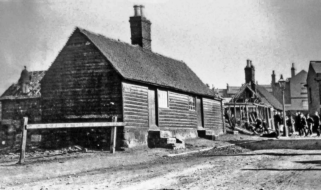
1794-95 - A ‘Signal Station’ was built where Fairlight Coastguard Station is today. This was one of a line of such stations set up by the government in late 1794 and early 1795 along the south coast, to monitor shipping movements, identify enemy vessels and communicate with defence forces by day and night. Each station consisted of a small wooden hut-cum-cottage, prefabricated in Portsmouth Dockyard, and an 80 feet high mast able to fly flags and display signal balls. All this was delivered by sea to the nearest landing site. The stations were managed by the Admiralty. When the stations closed, in December 1814, there were 26 along the coast between North Foreland and the Needles. Fairlight’s nearest neighbour to the east was at Dungeness point, while to the west there was initially an 18 mile gap to Beachy Head, but this made signalling so difficult that in 1811 intermediate stations were built at Galley Hill and Pevensey Bay. From Fairlight, on a clear day the big French military camp at Boulogne could be seen without a telescope. The fate of the Fairlight building immediately after 1814 is uncertain, but in 1818 the Admiralty decided to set up a semaphore system linking Deal and Beachy Head, with a station at Fairlight. The old building was probably demolished and replaced by a bigger Coast Blockade Service watch house and semaphore station. The new Popham semaphore system, invented by Rear Admiral Sir Home Popham in 1815, improved communications between the Blockade stations and revenue cutters. The semaphore was a tall mast with two arms, operated by chains running down inside the mast, which had a wooden shed around its base. Naval men inside the shed worked its arms. The semaphore network was installed over a period of years, covering the Kent coast and Sussex as far west as Beachy Head. Fairlight’s neighbours were Jury’s Gap to the east, Bexhill to the west. When the system became operational in 1820, it was handed over to the Coast Blockade Service. But most smuggling took place at night, so the network, though efficient, proved of little value, and it fell out of use around 1826.
1795 - A plan of the Fairlight Down estate of Sir Godfrey Webster shows a gibbet standing close to where North’s Seat is today. Victorian Hastings historian Thomas Brett in his Historico Biographies, published in about 1888, described how it came to be there. In
 The gibbet at North's Seat. On the right is Mill Lane, off Fairlight Road.
the late 18th century there was a barber named Lawrence Halliday who had a shop in the Old Town. Brett recalled: 'Among Halliday’s customers was an elderly gentleman who lived in a lonely house at or near the Fishponds, on the road to Fairlight [Barley Lane]. This man it was Halliday’s engagement to wait upon at stated intervals in his business capacity; and on one occasion he was tempted by the reputed wealth of his customer, the isolated position of the house and the facility afforded him in the use of the razor, to cut the throat of his victim, and then to rob the house. Some time elapsed before the murder was discovered, and even then no direct clue to the perpetrator of the deed was obtained until, as a stratagem, someone entered Halliday’s shaving-shop with the exclamation "Here’s the man who cut his customer’s throat!" Halliday, thinking, doubtless, that his visitor was a genuine accuser and intended to arrest him, fled precipitately from the premises, and thus betrayed his guilt. Officers were soon in pursuit of him, and, apprehended, he was tried and condemned to be hung in chains. The gibbet was erected at Fairlight.' Brett went on to say that a remnant of the gibbet could still be seen in about 1830 near the windmill then standing at North’s Seat. 'Halliday’s body was, I believe, the last that was so exhibited in this neighbourhood.'
1797-1806 - Three surveys were carried out in the Hastings area by the newly-formed Ordnance Survey as they prepared their first series of maps, the one inch-to-the-mile. The first survey was made in 1797 to the east of Hastings, at three inches-to-the-mile. It covered everything north of a line running east-west about 200 yards south of Fairlight Place, going west as far as Ore village (the bottom of this drawing has been cut off and lost). It shows the east end of Barley Lane extending in line to Fairlight Road, plus a road from just east of there going across the fields to Warren Farm, with no Coastguard Lane. The 1794 ‘Signal Station is marked as ‘Signal House’. Fairlight Down is common (open) land, as seems to be everything east of Warren Glen stream, south of Warren Farm as far as the Haddocks. Everything else is fields, apart from woodland at Pinders Shaw; Warren Glen gill and Brakey Bank. Warren Cottage is called Warren House.
 Part of the surveyor's drawings in the 1797 survey, with more detail than in the 1813 published map.
The second Ordnance Survey drawing was made in 1799, also at three inches-to-the-mile. In poor condition, it shows everything east of a line from the high land west of Fairlight Glen to just west of Fishponds Farm and then to Ore village. Fairlight Glen may be all woodland. Both glens are untilled. There is a building (probably a barn) about 100 yards east-south-east of where the New Barn was later sited, by today’s New Barn Pond; so it was presumably ‘new’ in relation to the old one in this map.
The third survey, at two inches-to-the-mile and carried out in 1806, is the only one covering the town of Hastings. It runs eastward from Pevensey Levels as far as Ecclesbourne stream, Pinders Shaw and Fairlight Down. All the Reserve area covered is shown as fields except for Fairlight Down (common land). The only woodland is Pinders Shaw. It also shows Fishponds Farm as being big (larger than on the 1799 drawing), with some buildings close to the lane. These three surveyor’s drawings - 1797, 1799 and 1806 - were redrawn in smaller scale at one inch-to-the-mile and published in 1813. The original three drawings can be viewed on the British Library website.
 The 1813 Ordnance Survey one inch-to-the-mile map, the first series of maps published by the Survey.